PROJECT - MediCargo

PROJECT - MediCargo

PROJECT - MediCargo

Medical drone logistics

Medical drone logistics

Medical drone logistics

A delivery drone for the highest quality standards in the field of medicine

A delivery drone for the highest quality standards in the field of medicine

A delivery drone for the highest quality standards in the field of medicine

The Project

Together with ADAC Luftrettung, we developed a fully autonomous logistics drone for the highly efficient transport of blood products. Its foundation was our Cargo Robot platform, which was extended by the project partner to include special features for flight safety and load security.

Together with ADAC Luftrettung, we developed a fully autonomous logistics drone for the highly efficient transport of blood products. Its foundation was our Cargo Robot platform, which was extended by the project partner to include special features for flight safety and load security.

Departure of the pre-programmed waypoint route with permanent intervention option

Departure of the pre-programmed waypoint route with permanent intervention option

The logistics system consists of drone, ground control station, ready-made IT interfaces and process flows

The logistics system consists of drone, ground control station, ready-made IT interfaces and process flows

Extremely wind-stable up to wind speeds of 10 m/s

Extremely wind-stable up to wind speeds of 10 m/s

Ultra-compact, foldable carbon design

Ultra-compact, foldable carbon design

100% data security through stand-alone concept

100% data security through stand-alone concept

Equipped with our genuine triple redundant flight control - Made in Germany

Equipped with our genuine triple redundant flight control - Made in Germany

AIRSENSE

AIRSENSE

AIRSENSE

Air situation display and UTM at new levels of performance

Air situation display and UTM at new levels of performance

Collision avoidance in the airspace between manned and unmanned aviation is becoming increasingly important. For drones beyond the visual line of sight, we have therefore developed AirSense, a high-performance system for effective detect and avoid (DAA).

Collision avoidance in the airspace between manned and unmanned aviation is becoming increasingly important. For drones beyond the visual line of sight, we have therefore developed AirSense, a high-performance system for effective detect and avoid (DAA).

Detection of ADS-B transponder and FLARM signals of manned aircraft

Detection of ADS-B transponder and FLARM signals of manned aircraft

Automatic airspace analysis with warning of critical approaches

Automatic airspace analysis with warning of critical approaches

Fail-safe processing of airspace data on a high-performance redundant server

Fail-safe processing of airspace data on a high-performance redundant server

Stand alone system or full integration into the Multirotor Ground Control Station (GCS)

Stand alone system or full integration into the Multirotor Ground Control Station (GCS)

Optional RTK - base station for the provision of correction data

Optional RTK - base station for the provision of correction data

Everything at a glance

Airspace monitoring in the Ground Control Station with AirSense DAA

DAA for drone logistics

AirSense can be booked stand alone as a DAA solution via direct access (laptop or smart device), but is also fully compatible with the Multirotor Ground Control Station (GCS).

DAA for drone logistics

AirSense can be booked stand alone as a DAA solution via direct access (laptop or smart device), but is also fully compatible with the Multirotor Ground Control Station (GCS).

DAA for drone logistics

AirSense can be booked stand alone as a DAA solution via direct access (laptop or smart device), but is also fully compatible with the Multirotor Ground Control Station (GCS).

One screen, more overview

Customers operating a multirotor drone with the latest, triple-redundant flight control generation beyond visual line-of-sight (BVLOS) receive the current air situation image of the environment directly in the live image of the GCS. This eliminates the need to operate a separate DAA solution with an additional screen, as is currently necessary when integrating third-party products.

One screen, more overview

Customers operating a multirotor drone with the latest, triple-redundant flight control generation beyond visual line-of-sight (BVLOS) receive the current air situation image of the environment directly in the live image of the GCS. This eliminates the need to operate a separate DAA solution with an additional screen, as is currently necessary when integrating third-party products.

One screen, more overview

Customers operating a multirotor drone with the latest, triple-redundant flight control generation beyond visual line-of-sight (BVLOS) receive the current air situation image of the environment directly in the live image of the GCS. This eliminates the need to operate a separate DAA solution with an additional screen, as is currently necessary when integrating third-party products.

Optional RTK

Its antenna module receives transponder signals and forwards them to the AirSense server via a mobile data connection. However, it can also be used as a base station to provide correction data. This enables the positional accuracy of the multirotor drone to within a few mm, which again opens up new possibilities, especially for fully autonomous landing.

Optional RTK

Its antenna module receives transponder signals and forwards them to the AirSense server via a mobile data connection. However, it can also be used as a base station to provide correction data. This enables the positional accuracy of the multirotor drone to within a few mm, which again opens up new possibilities, especially for fully autonomous landing.

Optional RTK

Its antenna module receives transponder signals and forwards them to the AirSense server via a mobile data connection. However, it can also be used as a base station to provide correction data. This enables the positional accuracy of the multirotor drone to within a few mm, which again opens up new possibilities, especially for fully autonomous landing.

Fast data acquisition

Flight paths of individual aircraft are traced over the last known positions, as well as identifier, flight altitude and type of air traffic (helicopter, aircraft or drone) are displayed.

Fast data acquisition

Flight paths of individual aircraft are traced over the last known positions, as well as identifier, flight altitude and type of air traffic (helicopter, aircraft or drone) are displayed.

Fast data acquisition

Flight paths of individual aircraft are traced over the last known positions, as well as identifier, flight altitude and type of air traffic (helicopter, aircraft or drone) are displayed.

G5PLUS FLIGHT CONTROLLER

G5PLUS FLIGHT CONTROLLER

100% Made by Multirotor

Triple-redundant set of independent flight controllers
Triple-redundant set of attitude, altitude, compass, and gnss sensors
Convenient interfaces
Encrypted communication uplink
High-density flight recorder

Flight safety equipment

Developed by ADAC Luftrettung

Transponder

Transponder
ADS-B and Flarm

See and be seen - aviation surveillance and visibility for air traffic up to a radius of 4 km

See and be seen - aviation surveillance and visibility for air traffic up to a radius of 4 km

Transponder
ADS-B and Flarm

See and be seen - aviation surveillance and visibility for air traffic up to a radius of 4 km

Redundant GPS

Redundant GPS
Redundant RTK GPS

High-precision RTK GNSS receiver incl. LTE connection to the correction service

High-precision RTK GNSS receiver incl. LTE connection to the correction service

Redundant GPS
Redundant RTK GPS

High-precision RTK GNSS receiver incl. LTE connection to the correction service

Parachute

Parachute
Rescue chute

Mechanical ejection without pyrotechnics

Mechanical ejection without pyrotechnics

Parachute
Rescue chute

Mechanical ejection without pyrotechnics

Laser Distance Meter

Laser Distance Meter
LiDAR

Laser distance meter for altitude determination

Laser distance meter for altitude determination

Laser Distance Meter
LiDAR

Laser distance meter for altitude determination

Drive

Drive
Sealed motors

Specially encapsulated and sealed motors against weather influences

Specially encapsulated and sealed motors against weather influences

Drive
Sealed motors

Specially encapsulated and sealed motors against weather influences

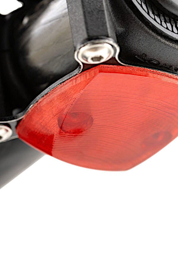
Lighting

Lighting
Flighting lighting

Multicoloured lighting as continuous and flashing light for night flights in accordance with §2 LuftVOLAnl1

Multicoloured lighting as continuous and flashing light for night flights in accordance with §2 LuftVOLAnl1

Lighting
Flighting lighting

Multicoloured lighting as continuous and flashing light for night flights in accordance with §2 LuftVOLAnl1

Load securing equipment

Developed by ADAC Luftrettung

Shutter

Shutter

CAD-developed central shutter with innovative mechanics

CAD-developed central shutter with innovative mechanics

Shutter

CAD-developed central shutter with innovative mechanics

Shutter Monitoring

Shutter Monitoring

Shutter monitoring by Hall sensor and magnet

Shutter Monitoring

Shutter monitoring by Hall sensor and magnet

Bluetooth

Bluetooth

Readout of the freight data blocker via Bluetooth and transmission of the data via LTE to the dispatch server

Readout of the freight data blocker via Bluetooth and transmission of the data via LTE to the dispatch server

Bluetooth

Readout of the freight data blocker via Bluetooth and transmission of the data via LTE to the dispatch server

Drone Specifications

Technical Data

Attitude control 512 times per second

Yes

Automatic treble control 24-bit barometric

Yes

Radar distance meter

Yes

Autonomous flight max. waypoints

up to 4000

Autostart-/Autolanding assistent

Yes

Transport container

Yes / Carbon with Central shutter / Cooler box 23x16x12 cm

Digital option port (for future applications)

Yes

Dimensions

Ø 85 cm, H 49 cm

Drive redundancy

Yes

Emergency Landing

Yes

Flightcontrol Multirotor G5plus redundancy

Yes/Triple

Flight data log

128 Hz

GPS flight assistant (Position hold, Coming home)

Yes

L1/L2 GPS, GLONASS, Beidou, Galileo

Yes/Triple

Flight Characteristics

Max. airspeed

50 km/h

Max. Flight time (ideal)

22 Min.

Max. Range (ideal)

15 km

Max. Take-off weight (ideal)

7500 g

Payload

1500 g

Wind stable till

10 m/s

Radio Links

LTE via all providers with MultiSIM

Yes / Double redundant with 2 Sim cards

Ground Control Station

Web based

Yes

Multiuser capable

Yes

RTK Correction service link

Yes

Real-time mission monitoring

Yes

Latency

< 0.5 s

G5plus Flight Control Specifications

Processors

3 independent control cores, 1 auxiliary core 216MHz ARM cortex M7

GPS

Ublox NMEA compatible interfaces for 3 external gps receivers (redundant) or 1 external receiver (non redundant)

Blackbox

SD HC memory card

Motor controller

MULTIROTOR proprietary (redundant) or pulse width modulated (non redundant)

Interfaces

CAN, UART, SPI, I2C, USB, WLAN

User extensions

Current attitude and position data is forwarded via CAN bus to customized sensor equipment. Time stamps of external events are stored on the blackbox.

SEE IT IN ACTION

See the stack fly.

Upgrade your airframe, improve your efficiency.

SEE IT IN ACTION

See the stack fly.

Upgrade your airframe, improve your efficiency.

SEE IT IN ACTION

See the stack fly.

Upgrade your airframe, improve your efficiency.